Sunday, September 8, 2013

Astoria

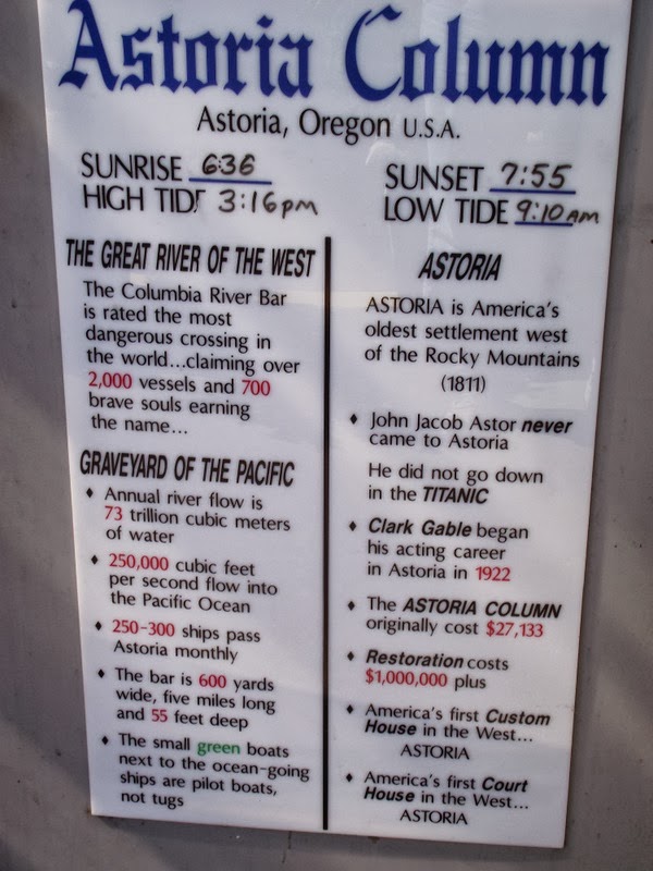
Astoria is a very interesting city. It is the first port after a ship clears the bar into the Columbia River. The area near the bar is the most dangerous place for shipping along the west coast. Over 2000 ships have been lost here in the past 300 years. There is a Maritime Museum with great displays of Coast Guard rescue ships and the pilot boats of the bar. There is a lot of history of the early explorers who came by sea. There is a lot about the development of the shipping industry up through Portland.


Shipwreck mapping


Full scale model of Coast Guard rescue
There were three ships on display moored at the dock. There was a Coast Guard Cutter, a bouy tender that is being retired and a retired floating lighthouse.

Floating lighthouse
Buoy tender
Literally straight up the hill from the museum is the Astoria Column. It sits on the highest point in Astoria. The history of Astoria winds around the tower and is created with a unique type of relief cut into layers of different coloured plaster.

Astoria Column

Astoria overlook
Clatsop boat overlooking creek leading to Fort Clatsop
Looks like San Francisco
Local shop sign

Wednesday, September 4, 2013

Fort Clatsop - Winter 1805 - 1806

Close to where we are camping is a recreation of Fort Clatsop where the Corps of Discovery spent the winter of 1805-1806. It was wet and stormy. In the 100 days they were there, the sun was out only 5 days. (We are having a similar experience). The fort lies along Lewis and Clark Creek (formerly Netul Creek). The area is a rain forest full of large cedar trees. They traded with the Clatsop Indians, built up stores for the trip home, repaired and remade clothes and explored the region.The visitor center had an excellent movie about the Clatsop Indians and their way of life. They are still in the area.


Fort Clatsop Recreation
Officer's room in Fort Clatsop
There was a path leading down to Netul Landing which was a marshy area where they landed their canoes.
Netul Landing
Dugout Canoe
We drove down the coast along the beach to Seaside. This was the location of the Salt Works where several of the corps spent 2 months boiling sea water to produce 34 bushels of salt to flavour and preserve their stores.  Apparently they had to come this far south to get to where there was enough salt content in the water. All the fresh water from the Columbia is carried south by the current. What is left are some piles of stones used to build big hot fires. They have a reenactment every year in August. We walked up and down the beach a bit.


Emily investigating fire pit
Ocean near Salt Works
Bailey at the beach
A little farther south of here is where L&C hiked in order to see a reported beached whale. They had never seen one before and were able to trade for some blubber. Sacagawea had asked to go as she had never seen a whale either.

Tuesday, September 3, 2013

Cape Disappointment

Here we go across the Columbia River again. Cape Disappointment is the SW corner of WA at the mouth of the Columbia. The bridge from Astoria is really high. Ocean going cargo ships have to get under there. The river is navigable up through Portland  and barges go up even farther.

Bridge before port of Astoria

Over the river we go
Ships in river waiting to be loaded or unloaded
The Corps of Discovery reached the Pacific Ocean here in 1805. They spent several miserable days at Dismal Nitch and moved down to Station Camp where there was a vote taken, that included the slave, York, and Sacagawea, which decided that they would spend the winter on the Oregon side of the river as there were reputed to be large herds of elk. Later, Clark led several men up the WA coast to see what the area was like.  Up near present day Long Beach, Clark saw his first sturgeon and was amazed at the size. It is also the home of the International Kite Museum. There are competitions here every year.

Big Bird Kite
Horse Kite
Clark and the Sturgeon
Farther up the beach, Clark carved his name in a tree. There is a memorial to this trip marking as far north on the coast that Clark ventured.

Clark's Tree
The carving
Plaque commemorating the end of the journey
There is a section of the Lewis and Clark Natl. Park at Cape Disappointment. There is a very well done Interpretive Center at the top of the bluff near the lighthouse.


Plaque at the center
As we drove back towards the bridge, we passed Station Camp and the Dismal Nitch. It was a beautiful day so we had trouble commiserating with the corps and the terrible time they had when trapped by a winter storm. This area is subject to really bad storms in the winter and is referred to as the graveyard of the Pacific.


Dismal Nitch
Then it was back across the river (again).


Monday, September 2, 2013

Over the river (again) and into the woods


Labour Day has finally arrived and we can get into a state park in Oregon close to Fort Clatsop. We have been trying to get in here since we left Bend. We cross the Columbia once again at Longview and reenter Oregon. The drive to the coast was through beautiful forests. We got to Astoria and crossed another river over to the peninsula.

Bridge from Longview
Crossing
View of the port from OR
Once again we are in a rain forest, though not as wet as in WA. We got to Fort Stevens State Park which is out on the farthest point into the Pacific at the mouth of the Columbia. Cape Disappointment is directly across the mouth of the Columbia.

Bridge from Astoria

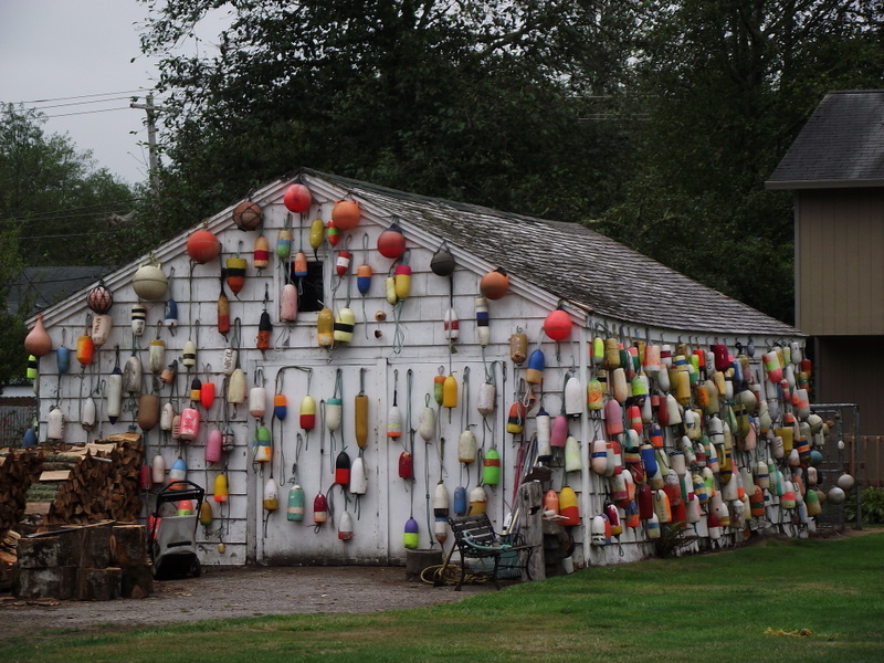
Oh buoy, look at this


Campsite
Typical tree size
We set out to see the ocean from the access points in the park. The first view of the Pacific was near the historic shipwreck of the Peter Eiredale. The next point of access is at the south jetty which was constructed to stabilize the sand bar of the Columbia. There is another jetty over at Cape Disappointment. There was a viewing tower at the jetty which gave quite a view of the ocean beach with the waves crashing on the rocks of the jetty.


Shipwreck


The South Jetty
Sunset on the Pacific